Significant incidentUpdated

Active Wildfire · Santa Fe County, NM

Frijoles Firenear Santa Fe County, NM

Opens in the app — start as a guest, no account needed

74%
Contained
Size
15,956acres
Status
Active
Discovered

From the ground

Latest photos from the fire

6 images · gathered by AI Discovery from official & local sources

Photos are gathered from official agency and local social sources and shown with attribution. Always follow official evacuation orders.

Live in the appPerimeter & evacuation zones update as agencies publish them.Open live map →
Current fire perimeter15,956 acres · updated

Updates

InciWeb·

NMSNF Frijoles Fire: Last updated: 2026-09-17 --- The type of incident is Wildfire and involves the following unit(s) Santa Fe National Forest. --- State: New Mexico --- Coordinates: Latitude: 35° 54 24.639130 Longitude: ...
· AI Discovery

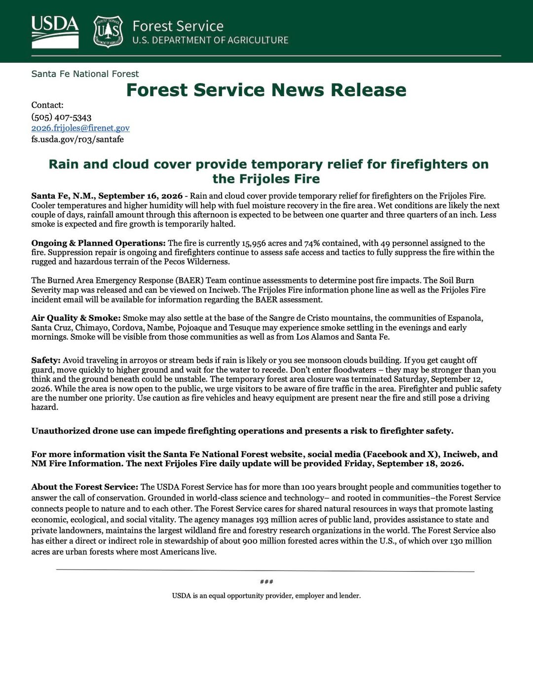
As of Sep 16, 2026, 1:36 PM MDT: Rain and cloud cover are providing temporary relief on the Frijoles Fire, with cooler temperatures and higher humidity aiding fuel moisture recovery. Fire growth is temporarily halted.

  • The fire is 15,956 acres and 74% contained, with 49 personnel assigned. (per U.S. Forest Service-Santa Fe National Forest · Facebook)
  • Rainfall through the afternoon is expected to be between one quarter and three quarters of an inch. (per U.S. Forest Service-Santa Fe National Forest · Facebook)
  • Suppression repair is ongoing; firefighters continue to assess safe access and tactics to fully suppress the fire within the rugged and hazardous terrain of the Pecos Wilderness. (per U.S. Forest Service-Santa Fe National Forest · Facebook)
  • The Burned Area Emergency Response (BAER) Team is continuing assessments to determine post-fire impacts; the Soil Burn Severity map has been released and can be viewed on InciWeb. (per U.S. Forest Service-Santa Fe National Forest · Facebook)
  • The temporary forest area closure was terminated Saturday, September 12, 2026. The area is now open to the public, though fire vehicles and heavy equipment remain present near the fire and pose a driving hazard. (per U.S. Forest Service-Santa Fe National Forest · Facebook)
  • Smoke may settle at the base of the Sangre de Cristo mountains; communities of Espanola, Santa Cruz, Chimayo, Cordova, Nambe, Pojoaque, and Tesuque may experience smoke in evenings and early mornings. Smoke will also be visible from Los Alamos and Santa Fe. (per U.S. Forest Service-Santa Fe National Forest · Facebook)
  • Residents are urged to avoid arroyos and stream beds during rain or when monsoon clouds are building due to flash flood risk. (per U.S. Forest Service-Santa Fe National Forest · Facebook)
  • The next daily update is scheduled for Friday, September 18, 2026. (per U.S. Forest Service-Santa Fe National Forest · Facebook)

🤖 AI summary of official posts; may lag or contain errors — verify with the source and official channels.

InciWeb·

NMSNF Frijoles Fire: Last updated: 2026-09-16 --- The type of incident is Wildfire and involves the following unit(s) Santa Fe National Forest. --- State: New Mexico --- Coordinates: Latitude: 35° 54 24.639130 Longitude: ...

WFIGS·

Personnel updated to 38.

InciWeb·

NMSNF Frijoles Fire: Last updated: 2026-09-15 --- The type of incident is Wildfire and involves the following unit(s) Santa Fe National Forest. --- State: New Mexico --- Coordinates: Latitude: 35° 54 24.639130 Longitude: ...

WFIGS·

Containment updated from 79% to 74%.

· AI Discovery

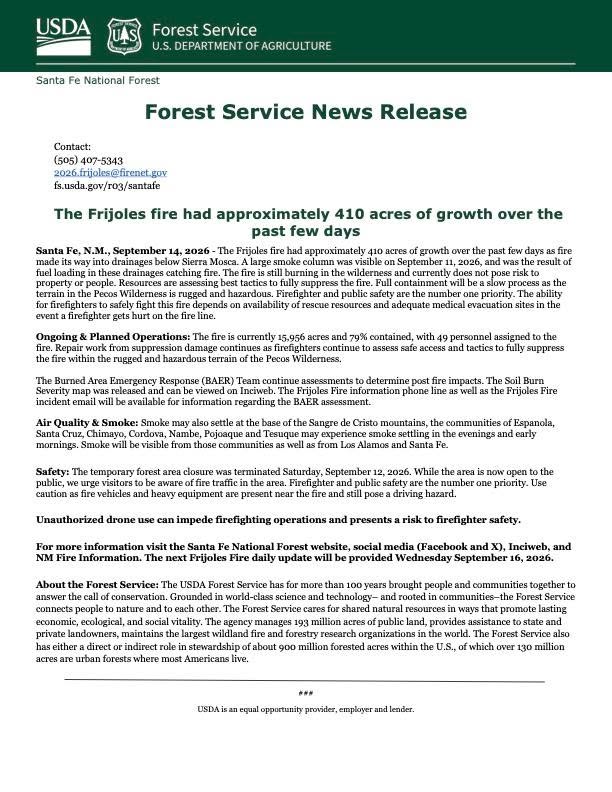
As of Sep 14, 2026, 11:21 AM MDT: The Frijoles Fire is burning in the Pecos Wilderness within the Santa Fe National Forest, currently 15,956 acres and 79% contained. The fire does not pose a risk to property or people at this time, though full containment is expected to be a slow process due to rugged and hazardous terrain.

  • The fire is 15,956 acres and 79% contained, with 49 personnel assigned. (per U.S. Forest Service-Santa Fe National Forest · Facebook)
  • Approximately 410 acres of growth occurred over the past few days as fire moved into drainages below Sierra Mosca. (per U.S. Forest Service-Santa Fe National Forest · Facebook)
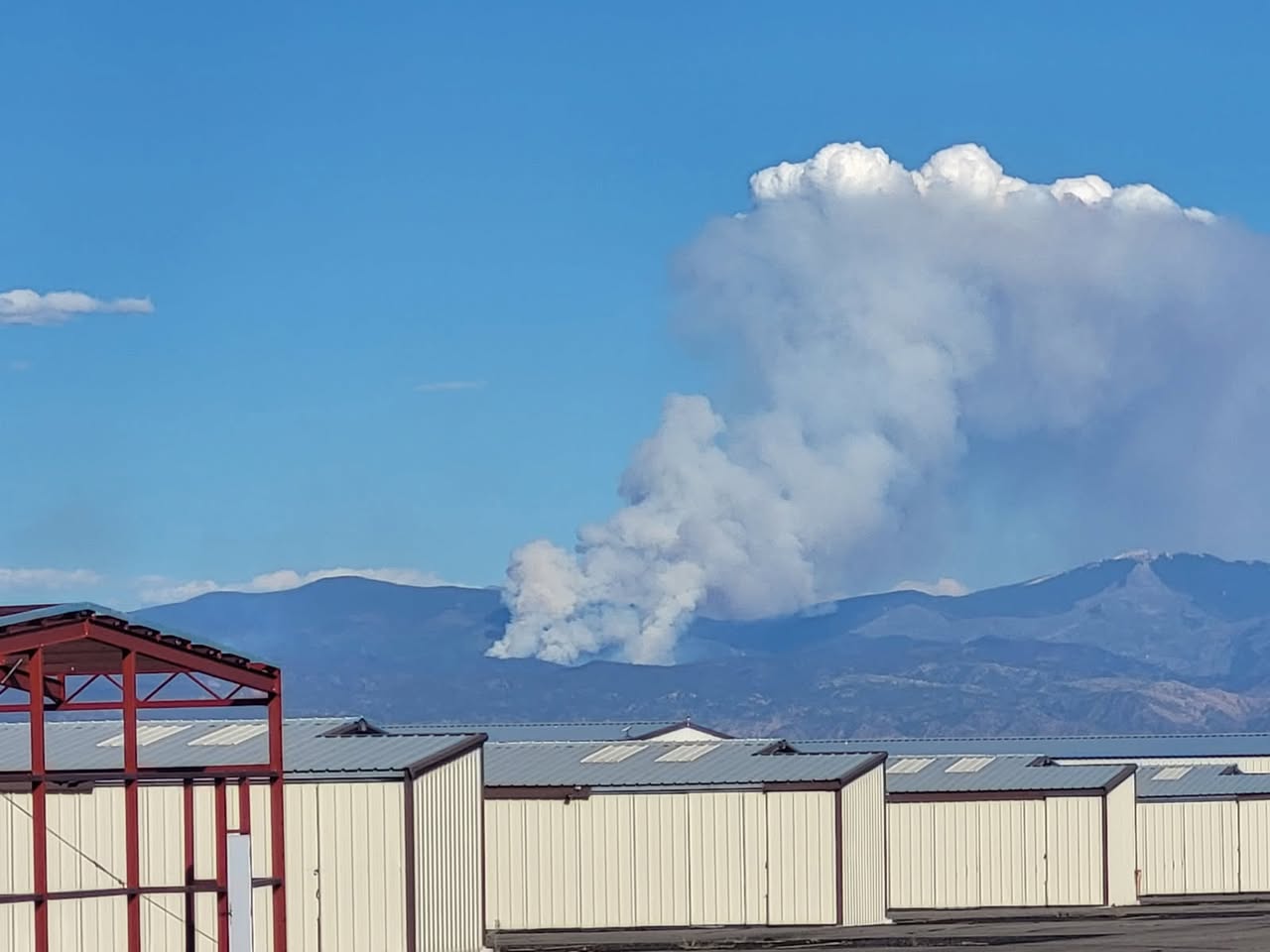
  • A large smoke column was visible on September 11, 2026, resulting from fuel loading in those drainages catching fire. (per U.S. Forest Service-Santa Fe National Forest · Facebook)
  • Resources are assessing best tactics to fully suppress the fire; repair work from suppression damage is ongoing. (per U.S. Forest Service-Santa Fe National Forest · Facebook)
  • The temporary forest area closure was terminated Saturday, September 12, 2026. The area is now open to the public, but fire vehicles and heavy equipment remain present near the fire and pose a driving hazard. (per U.S. Forest Service-Santa Fe National Forest · Facebook)
  • Smoke may settle at the base of the Sangre de Cristo mountains; communities of Espanola, Santa Cruz, Chimayo, Cordova, Nambe, Pojoaque, and Tesuque may experience smoke in evenings and early mornings. Smoke will also be visible from Los Alamos and Santa Fe. (per U.S. Forest Service-Santa Fe National Forest · Facebook)
  • The Burned Area Emergency Response (BAER) Team is continuing assessments; a Soil Burn Severity map has been released and is viewable on Inciweb. (per U.S. Forest Service-Santa Fe National Forest · Facebook)
  • Unauthorized drone use near the fire is prohibited, as it can impede firefighting operations and endanger firefighter safety. (per U.S. Forest Service-Santa Fe National Forest · Facebook)
  • The next daily update is scheduled for Wednesday, September 16, 2026. (per U.S. Forest Service-Santa Fe National Forest · Facebook)

🤖 AI summary of official posts; may lag or contain errors — verify with the source and official channels. ⚠️ Not an official evacuation order — follow your sheriff/emergency management.

InciWeb·

NMSNF Frijoles Fire: Last updated: 2026-09-14 --- The type of incident is Wildfire and involves the following unit(s) Santa Fe National Forest. --- State: New Mexico --- Coordinates: Latitude: 35° 54 24.639130 Longitude: ...

WFIGS·

Personnel updated to 49. Fire behavior: Minimal.

WFIGS·

Acreage updated from 15,547 to 15,956 acres. Fire behavior: Moderate.
· AI Discovery

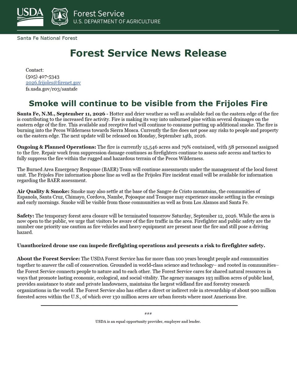
As of Sep 11, 2026, 5:01 PM MDT: The Frijoles Fire is 15,546 acres and 79% contained, with increased fire activity on the eastern edge driven by hotter, drier weather and available fuels. The fire is burning into the Pecos Wilderness toward Sierra Mosca but does not currently pose risks to people and property on the eastern edge.

  • Size: 15,546 acres (per New Mexico Forestry Division · Facebook; per U.S. Forest Service-Santa Fe National Forest · Facebook)
  • Containment: 79% (per New Mexico Forestry Division · Facebook; per U.S. Forest Service-Santa Fe National Forest · Facebook)
  • Personnel: 58 assigned to the fire (per New Mexico Forestry Division · Facebook; per U.S. Forest Service-Santa Fe National Forest · Facebook)
  • Fire behavior: Hotter and drier weather and available fuel on the eastern edge are contributing to increased activity; fire is moving into unburned pine within several drainages and burning into the Pecos Wilderness toward Sierra Mosca (per New Mexico Forestry Division · Facebook)
  • Suppression operations: Repair work from suppression damage continues; firefighters are assessing safe access and tactics to fully suppress the fire within the rugged and hazardous terrain of the Pecos Wilderness (per U.S. Forest Service-Santa Fe National Forest · Facebook)
  • BAER: The Burned Area Emergency Response Team will continue assessments under management of the local forest unit (per U.S. Forest Service-Santa Fe National Forest · Facebook)
  • Forest closure: The temporary forest area closure will be terminated Saturday, September 12, 2026; fire vehicles and heavy equipment remain present near the fire and pose a driving hazard (per New Mexico Forestry Division · Facebook)
  • Smoke: Smoke may settle at the base of the Sangre de Cristo mountains; communities of Espanola, Santa Cruz, Chimayo, Cordova, Nambe, Pojoaque, and Tesuque may experience smoke settling in evenings and early mornings; smoke will also be visible from Los Alamos and Santa Fe (per U.S. Forest Service-Santa Fe National Forest · Facebook)
  • Next update: Monday, September 14, 2026 (per New Mexico Forestry Division · Facebook)

🤖 AI summary of official posts; may lag or contain errors — verify with the source and official channels.
· AI Discovery

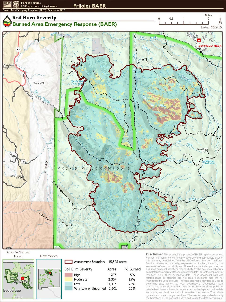
As of Sep 11, 2026, 4:20 PM MDT: The Frijoles Fire burned across a 15,483-acre footprint in the Santa Fe National Forest. A soil burn severity assessment has been completed by a Burned Area Emergency Response (BAER) team.

  • The fire's total footprint was 15,483 acres, located in the Santa Fe National Forest (per New Mexico Forestry Division · Facebook).
  • 80% of the burned area sustained low burn severity or no burn at all (per New Mexico Forestry Division · Facebook).
  • 15% of the burned area burned at moderate severity (per New Mexico Forestry Division · Facebook).
  • 5% of the burned area burned at high severity (per New Mexico Forestry Division · Facebook).
  • The BAER team — composed of hydrologists, soil scientists, and GIS analysts — used satellite sensing and on-the-ground assessment to determine how the fire affected the forest (per New Mexico Forestry Division · Facebook).
  • BAER results are used to determine post-fire risks to communities, such as erosion and flooding, and to develop a treatment plan (per New Mexico Forestry Division · Facebook).

🤖 AI summary of official posts; may lag or contain errors — verify with the source and official channels. ⚠️ Not an official evacuation order — follow your sheriff/emergency management.
· AI Discovery

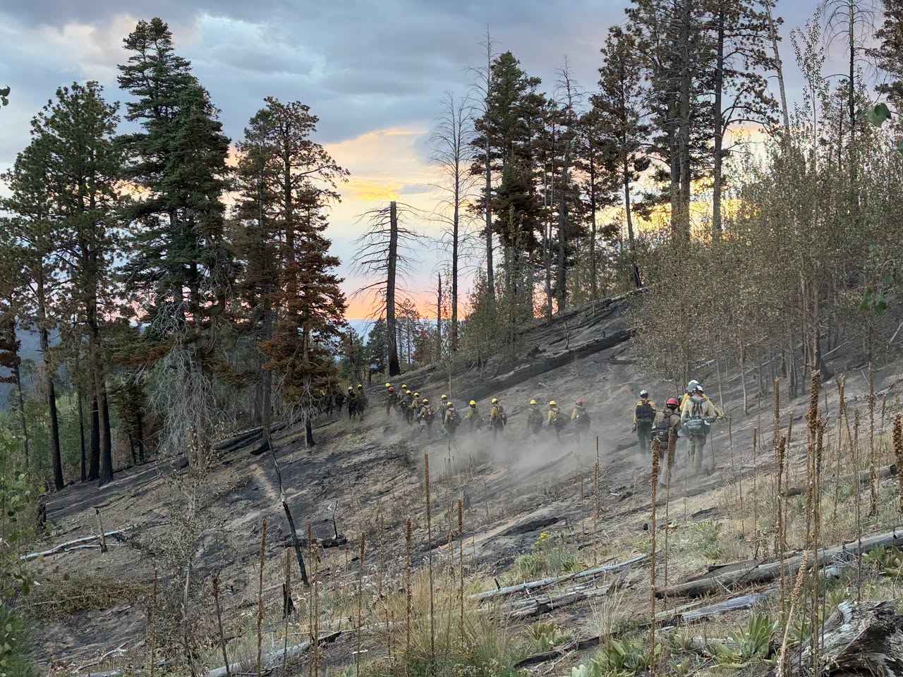
As of Sep 11, 2026, 11:25 AM MDT: The Frijoles Fire is burning in rugged terrain within the Pecos Wilderness, with hot and dry conditions expected to drive increased fire activity today.

  • Hot, dry conditions with lower humidity are anticipated to increase fire activity, with additional smoke expected from fuels burning in drainages along the eastern flank. (per U.S. Forest Service-Santa Fe National Forest · Facebook)
  • Firefighters are engaged and assessing the safest suppression strategy given the rugged, hazardous terrain of the Pecos Wilderness. (per U.S. Forest Service-Santa Fe National Forest · Facebook)
  • Evening and early morning cold air is expected to push smoke down into valleys; daytime heat should lift the smoke, with transport winds expected to carry it away by this afternoon. (per U.S. Forest Service-Santa Fe National Forest · Facebook)
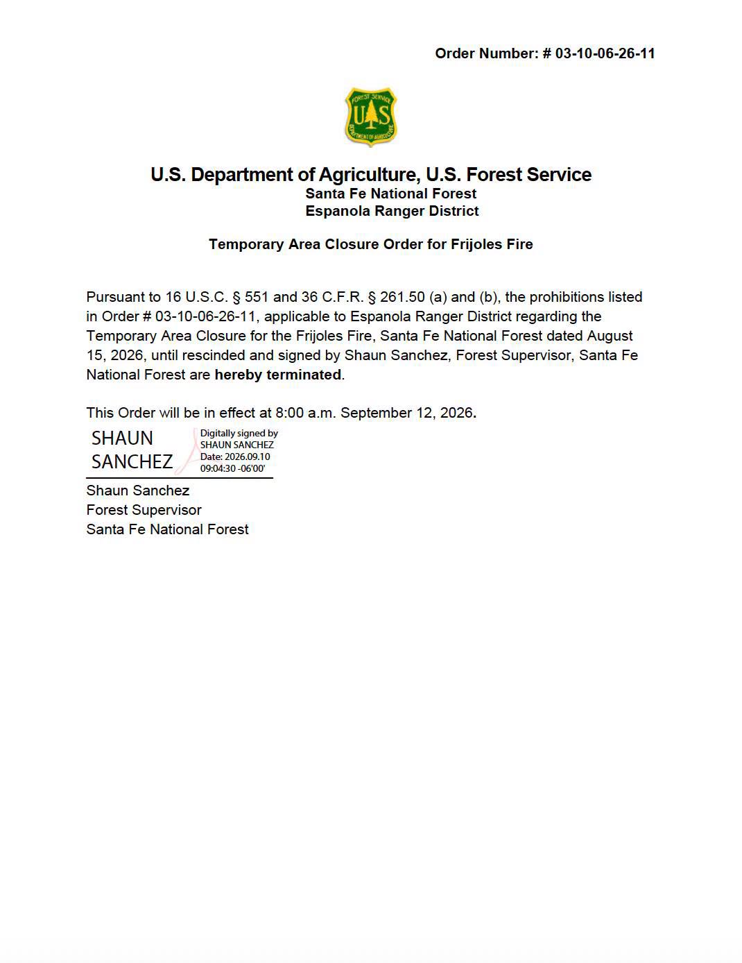
  • The closure order in place for the Frijoles Fire will be terminated on Saturday, September 12, 2026. Firefighters will still be actively engaged in the area, and the public is asked to be aware of fire traffic. (per U.S. Forest Service-Santa Fe National Forest · Facebook)

🤖 AI summary of official posts; may lag or contain errors — verify with the source and official channels.

Get updates like this the moment they happen.Push alerts for new evacuations, growth & containment changes — free.Follow this fire

Don't refresh this page. Let it find you.

  • Evacuation alerts for your zone — pushed as soon as we see an order, not hours later.
  • Live perimeter & growth — watch the fire move on the map as agencies update it.
  • Draw a zone around home — or anywhere your people are — and get the lead time to act.

Free · iPhone & iPad · Official + local sources · Start as a guest, no account needed

Example alerts

Data from official wildfire feeds and local agencies, refreshed regularly but not guaranteed real-time. Always follow official evacuation orders from local authorities.

Frijoles FireSignificant · 15,956 ac · 74% containedFollow