WFIGS·
Containment updated from 0% to 10%.
Active Wildfire · Runnels County, TX
Opens in the app — start as a guest, no account needed
Containment updated from 0% to 10%.
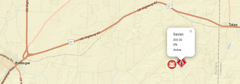
As of Sep 22, 2026, 2:05 PM MDT: The Seven Fire is burning in Runnels County, with Texas A&M Forest Service responding to a request for assistance.
🤖 AI summary of official posts; may lag or contain errors — verify with the source and official channels.
TXTXS Seven Fire: Last updated: --- The type of incident is Wildfire and involves the following unit(s) Texas A&M Forest Service. --- State: Texas --- Coordinates: Latitude: 31° 44 40 Longitude: 99° 45 40 --- NOTE:...
Acreage updated from 50 to 300 acres. Fire behavior: Moderate.
First report.
New fire reported. Acres: 50. Containment: 0%. Cause: Undetermined.
Free · iPhone & iPad · Official + local sources · Start as a guest, no account needed
Example alerts
Data from official wildfire feeds and local agencies, refreshed regularly but not guaranteed real-time. Always follow official evacuation orders from local authorities.