All U.S. wildfires

Wildfire Tracker

Washington wildfires

38 active wildfires across 17 counties in Washington. Browse by county, track live size and containment, and get alerted if a fire starts near your home.

Live· Updated Nov 2, 9:16 AM

Free · Official government updates · iOS 15+

Active fires
38
Counties
17
Acres burning
19,291
Avg contained
67%
Official data from
CAL FIRENIFCInciWebNASA FIRMSNOAA / NWSEPA AirNowFEMA

All active fires in Washington

THREE QUEENS Fire
Kittitas County, WA
SISI Fire
Chelan County, WA
KING Fire
Kittitas County, WA
PETERSON Fire
KLICKITAT County, WA
BLYTON LANDING Fire
WHITMAN County, WA
JUNCTION Fire
KLICKITAT County, WA
MARYHILL Fire
KLICKITAT County, WA
WARWICK Fire
KLICKITAT County, WA
NACHES TIETON GRADE Fire
YAKIMA County, WA
ALMOTA Fire
WHITMAN County, WA
THOMPSON Fire
YAKIMA County, WA
SADDLE VIEW DRIVE Fire
OKANOGAN County, WA
WASHBURN Fire
DOUGLAS County, WA
SURRO Fire
SPOKANE County, WA
PATTERSON CREEK Fire
OKANOGAN County, WA
HEINE MARSH Fire
STEVENS County, WA
DALLESPORT ROAD Fire
KLICKITAT County, WA
ORCHARD HEIGHTS Fire
KLICKITAT County, WA
STANLEY Fire
SPOKANE County, WA
STRANGE ROAD Fire
KITTITAS County, WA
CLEMAN Fire
YAKIMA County, WA
WEST HAWTHORNE Fire
SPOKANE County, WA
PARADISE Fire
OKANOGAN County, WA
SIMMONS LAKE Fire
THURSTON County, WA
MEAD Fire
SPOKANE County, WA
GRANITE Fire
SPOKANE County, WA
MEDINA Fire
SPOKANE County, WA
LOWER PINE Fire
PEND OREILLE County, WA
ROADSIDE Fire
GRAYS HARBOR County, WA
MONSE RIVER ROAD Fire
OKANOGAN County, WA
TRUCK ROUTE Fire
CLALLAM County, WA
FIR POINT Fire
SKAMANIA County, WA
GARBAGE PIT Fire
CLARK County, WA
BEAVER VALLEY Fire
JEFFERSON County, WA
ALKALI Fire
CHELAN County, WA
SEAMAN ROAD MUTUAL AID Fire
WALLA WALLA County, WA
SNACK SHACK Fire
OKANOGAN County, WA
HEXON Fire
YAKIMA County, WA

See it in action

See every fire. Protect every place you love.

Watch what's burning right now, then create alert zones around your home, family, ranch, and animals — or follow entire counties and states. WildFireVantage warns you the moment fire moves toward any of them, with the lead time to act.
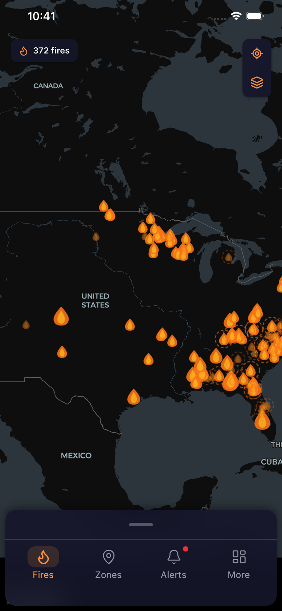
WildFireVantage app showing the live map of active wildfires across the U.S.
Every active fire, live
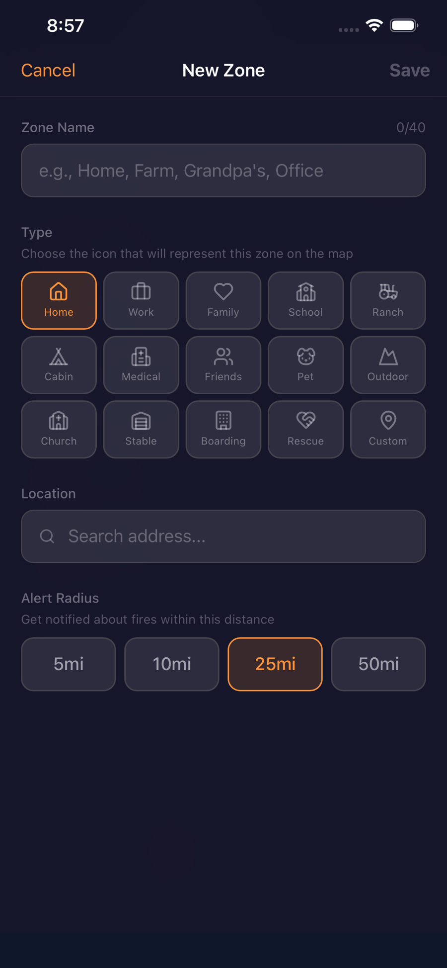
Setting up a WildFireVantage alert zone around a home, ranch, or family with a chosen radius
A zone around all you love
Download on theApp StoreFree on the App Store · iOS 15+

Premium

Watching more than one place? Go Premium.

Core safety alerts are free forever. Premium is for people protecting a whole life — from $2.99/mo or $29.99/yr.

See Free vs PremiumCancel anytime
  • Watch 15 places, not 3
    Your home, your parents', the ranch, the animals — protect everywhere you love, not just one address.
  • 21+ live map layers
    Wildfire cameras, aircraft, satellite hot spots, smoke, and air quality — see exactly what a fire is doing.
  • Offline maps
    Your saved zones keep working when you're evacuating and the cell network drops out.

Get wildfire alerts for your part of Washington

Create an alert zone around your home, ranch, or family — or follow every fire in Washington — and WildFireVantage tells you the moment a fire starts nearby, with the lead time to act.

Download on theApp StoreFree on the App Store · iOS 15+